

In this story
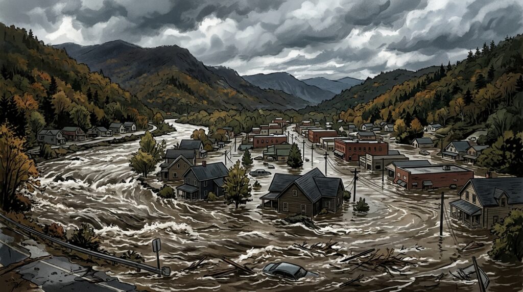
Torrential downpours from an expansive cross-country storm produced severe Georgia Tennessee border flooding early Thursday, November 5, 2026. The sudden influx of water pushed local river basins past their limits, quickly swamping residential roadways and prompting emergency teams on both sides of the state boundary into immediate field operations. As water levels rose through the dark morning hours, officials placed Fannin County in north Georgia and adjacent Polk County in southeast Tennessee under Flash Flood Emergencies to warn of life-threatening conditions.
Runoff gathered swiftly across the shared mountain border region, sending floodwaters directly into neighborhood streets and reaching the interiors of multiple homes. The rapid inundation gave emergency management agencies little time to stage assets before having to execute urgent swiftwater operations. Over the course of the morning, local authorities navigated a multi-layered emergency that encompassed residential rescues, structural fires, an industrial explosion, and widespread municipal closures.
Pre-Dawn Evacuations and Municipal Shutdowns
The adjoining border communities of McCaysville, Georgia, and Copperhill, Tennessee, faced the immediate brunt of the deluge. Separated only by the state line, both towns experienced fast-moving water in low-lying sections long before sunrise. The McCaysville Police Department acted just before 3:00 a.m. local time, instructing residents living in several affected neighborhoods to evacuate immediately as streets began to submerge.
As floodwaters continued to spread through the town over the following two hours, municipal leaders expanded formal protections. Just after 5:00 a.m., the City of McCaysville officially declared a state of emergency. This measure allowed local agencies to mobilize municipal resources and direct emergency personnel to the most heavily impacted residential pockets.
Directly across the border, municipal officials in Copperhill took drastic measures of their own. The City of Copperhill announced that the city was closed to regular activity, issuing explicit warnings for people to stay away from the downtown core and avoid all locations bordering the swollen river. To protect students and keep non-essential vehicles off flooded roadways, Polk County Schools canceled all classes and closed district buildings for the remainder of Thursday.
Record Crests Along the Toccoa and Ocoee Rivers
The primary driver behind the severe regional inundation was an extraordinary accumulation of rain within a compact window. Meteorological data reported by FOX Weather showed that between 5 and 8 inches of rain fell across the border area within just 12 hours. The deluge poured over steep, saturated hillsides, funneling immense quantities of surface runoff directly into the primary regional drainage basin.
The rapid influx caused the river system—identified as the Toccoa River on the Georgia side of the border and the Ocoee River once it crosses into Tennessee—to surge well past historical levels. Hydrological observations indicated that the river system surged to a record crest exceeding 18 feet. This new watermark eclipsed prior regional flood records, pushing water deep into shoreline properties and residential parcels that typically remain dry.
The surging currents inundated adjacent yards, blocked neighborhood access points, and seeped into multiple residences across Fannin County. The sheer speed of the rise created hazardous swiftwater conditions, making ordinary vehicle travel impossible and cutting off physical escape routes for several households.
Swiftwater Rescues, Aviation Staging, and Emergency Sheltering
With water inside homes and yards submerged, emergency responders across Fannin County commenced intensive water rescue operations. County officials confirmed that dedicated swiftwater rescue teams deployed boats and protective gear into inundated sectors to extract residents isolated by the currents.
Working through hazardous, debris-laden water, water rescue teams successfully pulled at least 20 people to safety in Fannin County, according to FOX Weather. First responders operated continuously across flooded neighborhoods to ensure that residents unable to self-evacuate were reached and moved out of high-risk properties.
To support families and individuals displaced by the high water, local officials activated county facilities. The Fannin County recreation center opened as an emergency shelter, providing a temporary base and immediate assistance to residents forced from their homes. State assets were also mobilized for backup; the Fannin County Emergency Management Agency confirmed that Georgia State Patrol helicopters were placed on standby to assist with aerial evacuations if rising currents completely blocked boat operations.
Secondary Storm Hazards: Building Fires and an Explosion
The weather crisis was further complicated by dangerous secondary incidents in flooded sections of the region. In McCaysville, floodwaters contributed to a hazardous materials emergency when a propane tank outside a local business caught fire and exploded, FOX Weather reported. The blast generated an active fire scene that required immediate attention from emergency personnel who were already managing widespread water rescues.
Simultaneously, severe weather conditions triggered fire alarms in other parts of the county. Fannin County officials reported that several buildings caught fire during the storms. Emergency managers noted that lightning strikes associated with the storm system were believed to be the cause of these structural fires, forcing local fire crews to combat blazes while navigating water-covered and debris-strewn roadways.
Inter-Agency and Multi-State Response Coordination
The border-spanning nature of the disaster prompted a coordinated, multi-jurisdictional emergency mobilization. Georgia Governor Brian Kemp announced that a multi-agency and multi-state response was underway to support affected communities across northern Georgia and southeastern Tennessee.
According to Governor Kemp, the relief framework pooled resources from key state organizations, including the Georgia Emergency Management and Homeland Security Agency, the Georgia Department of Public Safety, and the Georgia Department of Natural Resources Law Enforcement Division. These state personnel integrated directly with county officials in Georgia and emergency crews operating in Tennessee.
The joint operation focused on deploying boat and aviation assets along the Toccoa and Ocoee river basin. By combining state and local resources across both jurisdictions, emergency authorities maintained ongoing surveillance of river conditions, conducted targeted property checks, and ensured first responders could reach isolated residents as high water persisted across the state line.